|
#1
 March 15th, 2016, 12:38 PM
| |||
| |||
|
I am doing MA Geography from Rajasthan University and got final year assignment looking for the details about Union Territories In India. Can you please provide me Indian map in which Union Territories is located and also provide me list of union territories and states of India? The Government of India and Union territories form a part of the structure of the Republic of India. The Union territories are under direct administrative rule of the central government with its center at the national capital city of Delhi. The list of Union territories included in the Republic of India constitution is: Andaman and Nicobar Islands Dadra and Nagar Haveli Lakshadweep Puducherry Chandigarh Daman and Diu New Delhi Map: 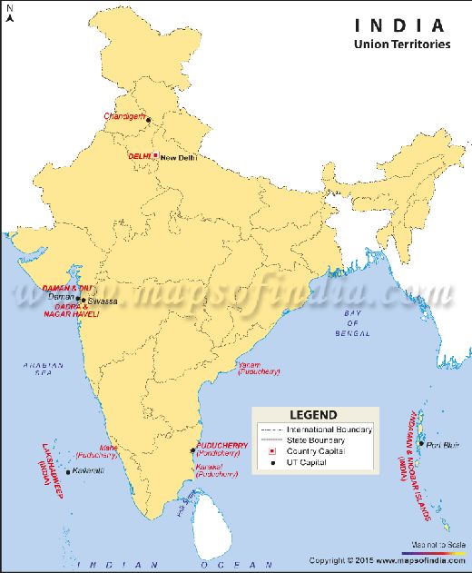 List of Indian States: Andhra Pradesh Arunachal Pradesh Assam Bihar Chhattisgarh Goa Gujarat Haryana Himachal Pradesh Jammu & Kashmir Jharkhand Karnataka Kerala Madhya Pradesh Maharashtra Manipur Meghalaya Mizoram Nagaland Odisha (Orissa) Punjab Rajasthan Sikkim Tamil Nadu Telangana (from June 2, 2014) Tripura Uttar Pradesh Uttarakhand West Bengal Last edited by Aakashd; February 19th, 2020 at 09:52 AM.  |


